Key benefits of building with Mapbox
- Mapbox Navigation provides reliable route information even in remote areas, with detailed road coverage and high-resolution satellite imagery.
- The smart defaults of the Mapbox Navigation SDKs make it easy to integrate in-app navigation features, including automatic offline caching for uninterrupted navigation.
- Mapbox Maps provide polished, high-quality basemaps with flexible options to customize map appearance on both mobile and web.
products used
About OilTrails
OilTrails is a specialized navigation application designed for oil and gas field teams working in remote locations. Founded by Craig Hewlett, an industry veteran who personally experienced the challenges of field navigation, OilTrails simplifies the process of locating well sites and navigating off-grid roads. The app eliminates reliance on outdated paper maps and unreliable navigation tools, offering an intuitive, field-tested solution tailored to the unique needs of oilfield workers.
OilTrails takes pride in its usability-focused design, offline-first functionality, and industry-specific enhancements. Its ability to provide reliable navigation, even in areas with no cellular connectivity, sets it apart in the market. The app's competitive edge lies in its seamless integration of industry-specific location lookup systems, proprietary conversion algorithms, and high-quality satellite imagery, all supported by the advanced mapping and navigation tools built with Mapbox.
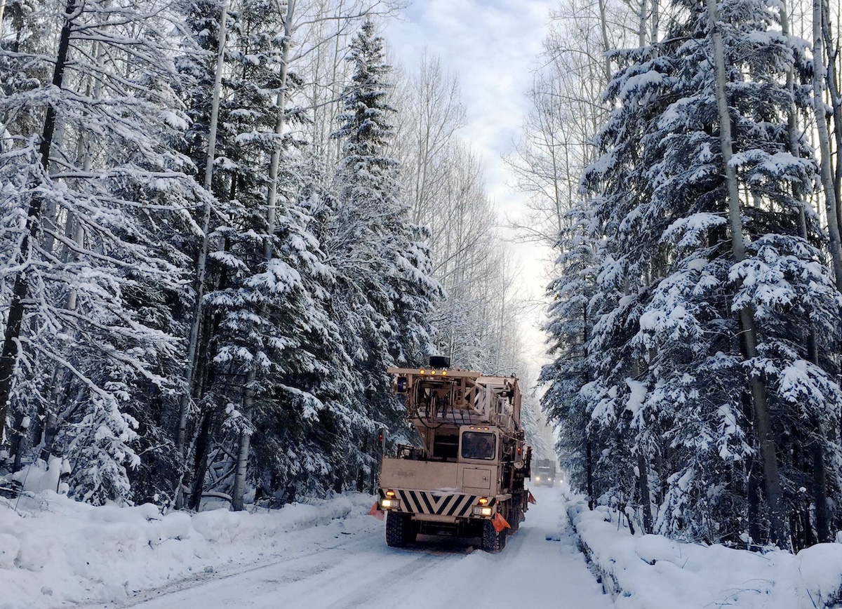
The demands of oilfield navigation
Oilfield work takes place in some of the most remote and challenging terrains, where standard mapping services often fall short. Crews had traditionally relied on physical maps, which quickly became obsolete. In addition, cellular service is often unavailable in these locations, making online-only mapping solutions unreliable.
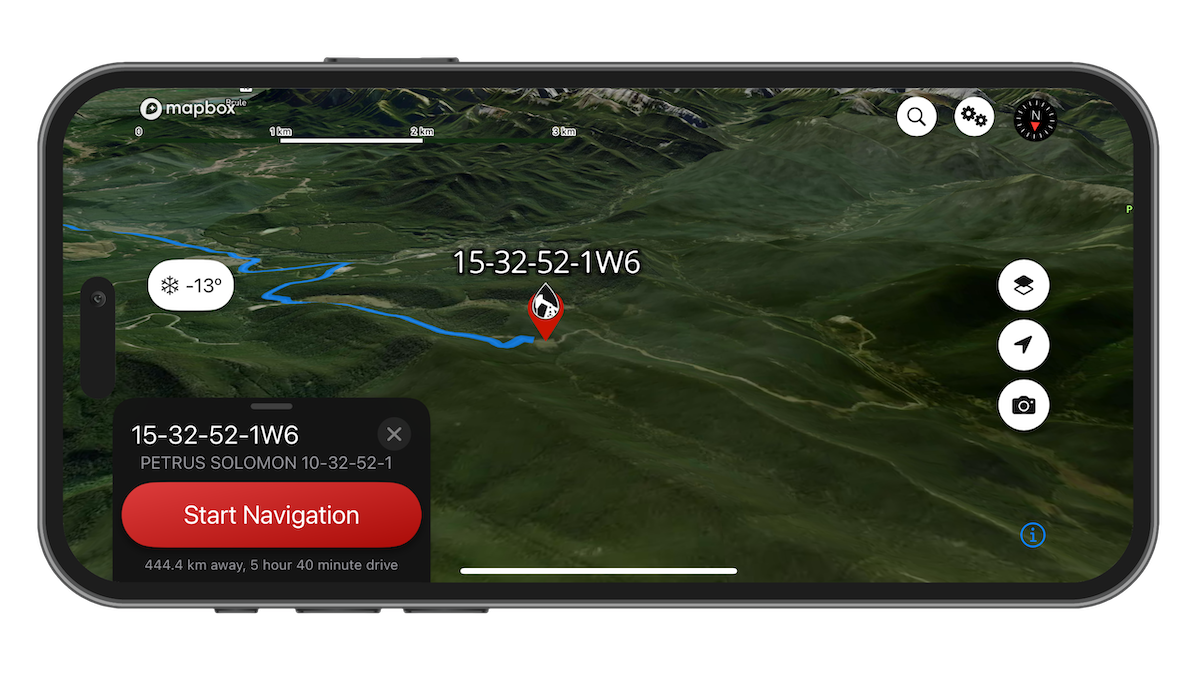
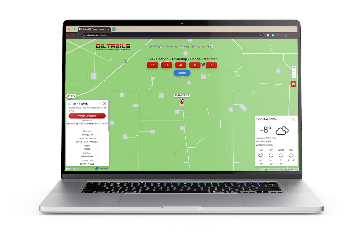
In the first version of OilTrails, the user would enter a code for a specific LSD, a type of legal subdivision for land in Canada. The app would parse that, send it to a third party API, return GPS coordinates, then opened the location in Google Maps in order to view a map and get directions. But relying on Google Maps limited customization options and created a break in the user experience. Then in 2016, Apple rejected OilTrails from the App Store because it included screenshots that used Google Maps imagery. It was time for OilTrails to adopt a customized in-app mapping solution.
I first tried Mapbox just for navigation, but quickly realized their satellite imagery and remote road data were far superior to what I'd used before, especially in oilfield regions. The quality was so impressive that we ended up switching to Mapbox for all our mapping needs.
Craig Hewlett, CEO, Ash Point Software
Mapbox provides a superior, full-featured solution
OilTrails chooses to build with Mapbox for its powerful mapping, navigation, and offline capabilities. The decision to build with Mapbox was driven by ease of implementation and the superior map quality for remote regions compared to competitors. The ability to customize the map appearance and keep users in-app even during turn-by-turn navigation allows OilTrails to create a more cohesive experience for users. The offline functionality of the Mapbox Navigation SDKs automatically caches road data, enabling seamless navigation in areas without service. And high-resolution satellite imagery from Mapbox allows field teams an alternative way to verify routes when remote road data is incomplete.
OilTrails now integrates Mapbox as its primary mapping solution across both Android and iOS versions of the mobile app, while also using Mapbox navigation capabilities as a key component of the app's comprehensive navigation system. The cross-platform nature of Mapbox means that OilTrails also uses Mapbox GL JS for the OilTrails web application, ensuring an accurate and consistent experience across devices regardless of whether teams are planning routes in advance or navigating in the field.
Honestly, Mapbox just clicked for us from day one. It keeps delivering exactly what we need, sometimes before we even know we need it.
Craig Hewlett, CEO, Ash Point Software
Navigation features that are easy to build and reliable to use
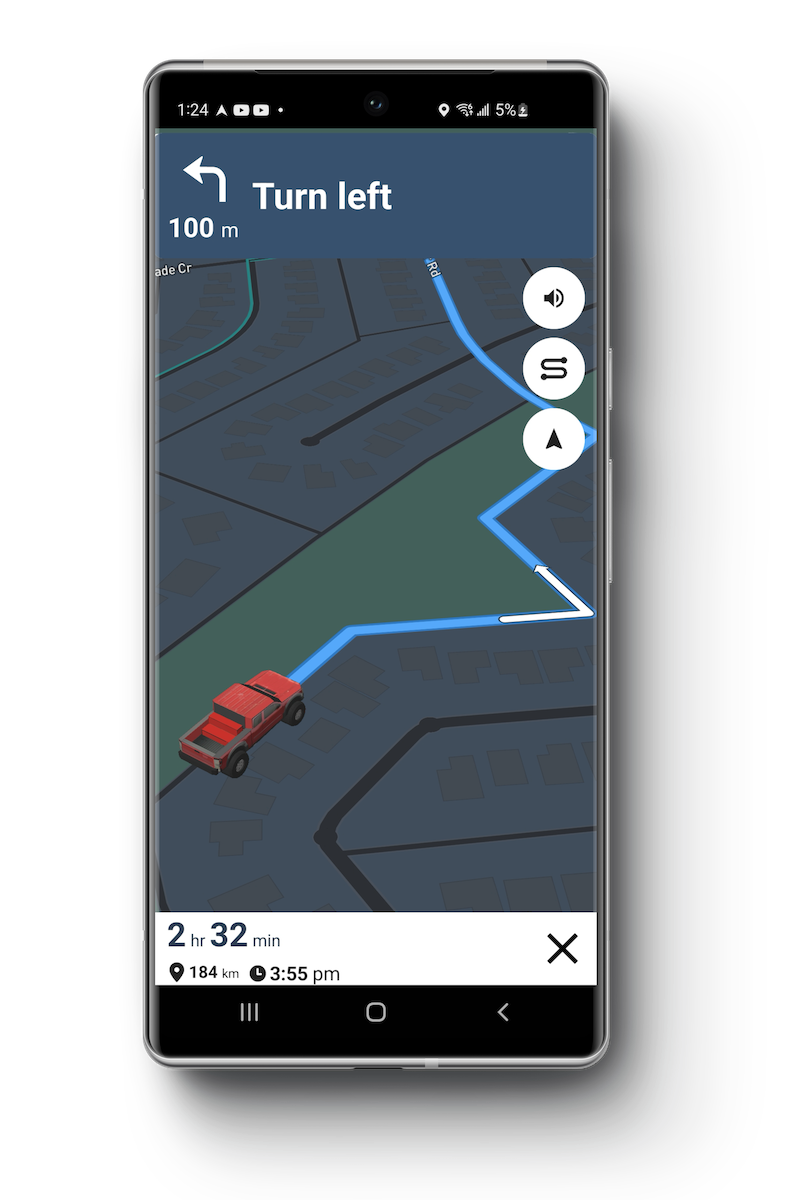
Using the Mapbox Navigation SDKs, route planning and turn-by-turn directions are seamlessly integrated into the OilTrails application. The Mapbox Directions API calculates routes that are overlaid on the visual map, and then users can initiate turn-by-turn navigation with a single tap.
For the navigation features, OilTrails uses the default settings from the Mapbox Navigation SDKs via the NavigationController, making it easy to implement and maintain. The customization of the navigation experience comes with the user’s selection of preferred map style and the option to add a 3D model pickup truck for the user marker (in the Android version).
OilTrails is built with an offline-first approach. A proprietary location lookup system converts coordinates on-device, reducing dependence on online services. This system is complemented by the caching of road data that is automatic in the Mapbox Navigation SDKs, ensuring that users can continue navigating even in areas without network coverage.
OilTrails was built to work offline from day one – it's essential in the oilfield. Mapbox automatic caching aligns perfectly, keeping maps available even when there's no signal.
Craig Hewlett, CEO, Ash Point Software
Mapbox is a high-quality and affordable solution for developers
OilTrails has successfully created a navigation tool that oil and gas workers can trust, no matter how remote their job site may be. OilTrails’ integration with Mapbox has helped to keep it consistently ranked as the top choice app for oilfield navigation for over a decade. Workers waste less time and fuel searching for locations, and lower their risk of getting lost in remote areas. The app’s high-quality basemaps render smoothly even in low-connectivity areas, navigation features perform well even with spotty service, and the satellite imagery map style is highly detailed.
Our goal has always been to make our app easy to use but robust enough for the tough demands of field work. Our users rely on OilTrails daily in some pretty challenging conditions, and the Mapbox integration has always proven reliable.
Craig Hewlett, CEO, Ash Point Software
Building with Mapbox allowed OilTrails to create a solution specifically designed for the oil and gas industry. With navigation and map solutions that are designed to be easy to implement, with usage-based pricing, Mapbox makes it easy for developers to add reliable and professional grade location features to their highly tailored applications like OilTrails.
For niche developers like us, what I love about Mapbox is that it handles all the heavy lifting for maps and navigation. This lets us pour our energy into the specialized features that make OilTrails unique.
Craig Hewlett, CEO, Ash Point Software