Back to all cases
Mapbox outfits Backroad Maps to build navigation experiences of Canada’s backcountry, increasing premium subscriptions by 15% and revenue by 25%.

Key benefits of building with Mapbox
- Mapbox helped Backroad Maps translate its web experience into a stable and performant mobile environment — online or offline.
- The Mapbox Navigation SDK enables support for Apple CarPlay and Android Auto, transforming the mobile app into a complete navigation solution.
- After receiving countless requests for 3D maps, Backroad Maps built advanced 3D mapping capabilities for all of Canada — and draped its custom Adventure Overlays on top.
products used
About Backroad Maps
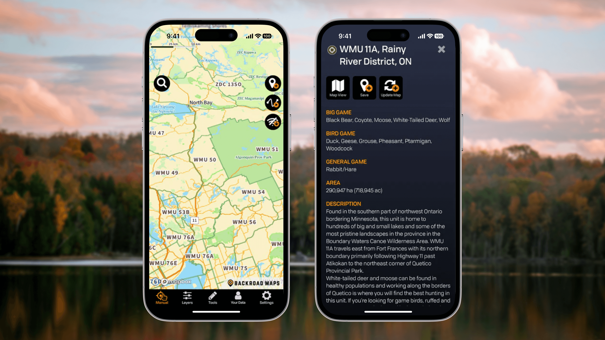
Backroad Maps is a Canadian mapping company specializing in detailed outdoor recreation maps and navigation tools. For more than 30 years, the company has produced printed mapbooks, waterproof maps, and digital mapping products that cover backroads, trails, lakes, and recreation sites across Canada.
Designed for people who fish, hunt, paddle, hike, ride, and explore off the beaten path, Backroad Maps products combine accurate cartography with practical local knowledge — so users can confidently find and enjoy places far beyond paved roads and urban coverage.
Today, Backroad Maps is focused on bringing its trusted outdoor guidance into a modern digital platform, pairing a powerful mobile app with the high-quality cartography the brand is known for.
Scaling a trusted outdoor mapping experience to mobile
Backroad Maps had long been recognized for the quality of its printed maps and GPS products. For years, Backroad Maps used a web map built with Mapbox GLJS to showcase its proprietary basemap data and adventure overlays, along with essential tools for waypoints, routes, and trip planning. But as customer expectations shifted toward mobile-based experiences, the team needed a way to deliver its detailed outdoor data to smartphones in a stable, performant, and scalable mapping environment.
An early version of its app, built with a different mapping framework and external development team, revealed clear limitations. Performance issues persisted, such as when zooming into the map on iOS, the map would render blurry cached images of trail lines from previous map scales. The team was unable to satisfy feature improvement requests and lacked the flexibility to evolve the product at the pace customers expected.
Advanced mobile mapping without sacrificing cost or control
Backroad Maps decided to bring development of its app in-house and rebuild the experience from the ground up. The engineering team evaluated multiple mapping frameworks based on functionality, cost, and suitability for outdoor navigation. Mapbox stood out for its technical capabilities, developer-friendly architecture, offline support, and cost-effectiveness.
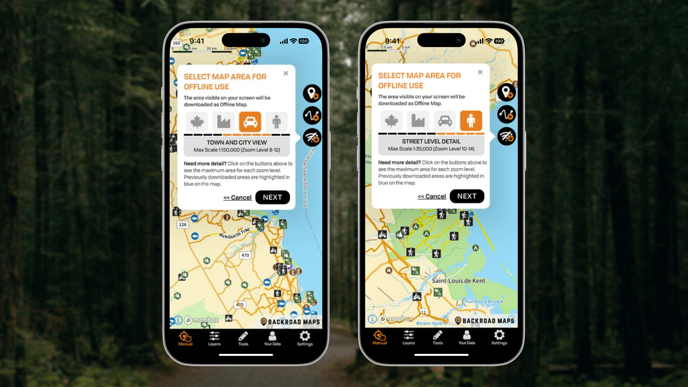
Most importantly, Mapbox provides best-in-class offline mapping support for mobile applications. As well, the Backroad Maps team realized that using one platform for all location capabilities — spanning maps, search and navigation — would make development more efficient. And finally, Mapbox offered cost-effective usage during early development phases when the map features were not driving much revenue. Backroad Maps stakeholders quickly saw what was possible with Mapbox, committing to a full rollout on the Mapbox platform — including launching the updated iOS and Android apps in 2020 using the Mapbox Mobile Maps SDKs.
“What we found is that the development from web maps and mobile apps translates between one another fairly consistently. Additionally, one of the main advantages of developing with Mapbox was the generous free tiers they provide for the various SDKs and APIs. For the first few years, our costs remained very nominal while we were building and advancing our mapping functionality and growing our customer base.” Russell Mussio, President & Co-founder, Backroad Maps
A rich, offline-ready outdoor navigation experience
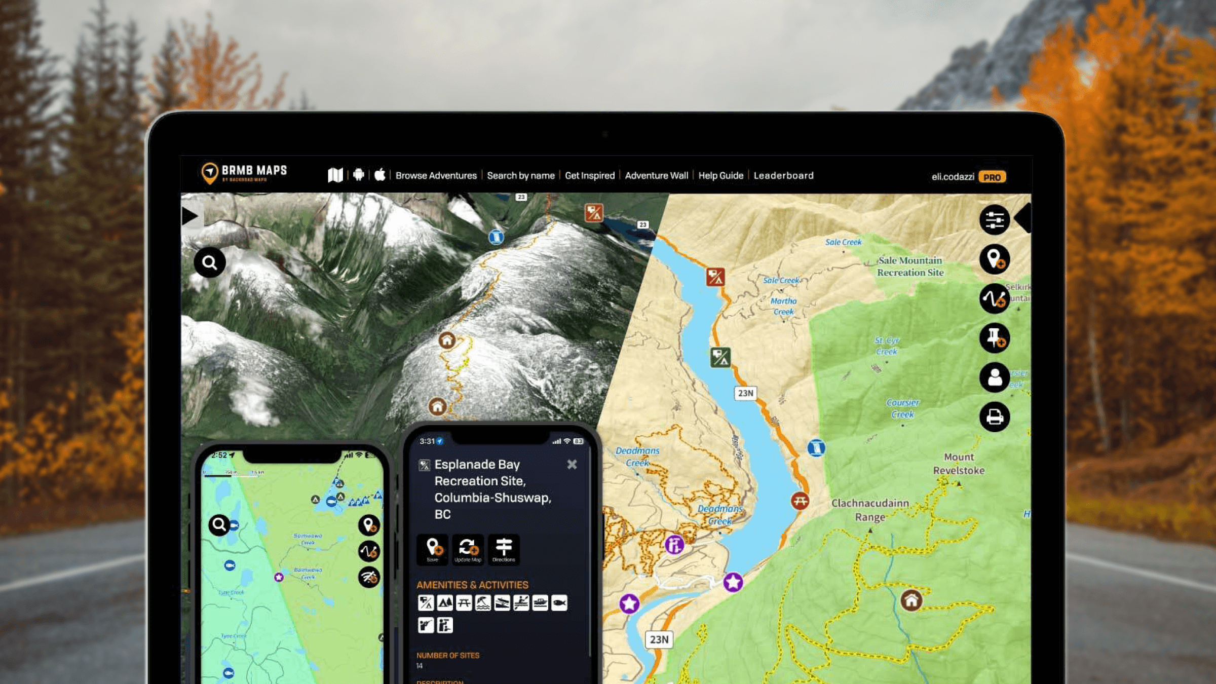
Using Mapbox, the Backroad Maps mobile app delivers a highly detailed, layered map experience that combines its proprietary outdoor data with the Mapbox global mapping platform.
“I wanted to continue to use Mapbox as we had so much success with the Mapbox GL JS integration. The mobile SDKs offered offline mapping functionality which was the most critical criteria for our project since our customers rely on us for navigating where no cell or data connections are available.” David Mancini, GIS Manager & Developers, Backroad Maps
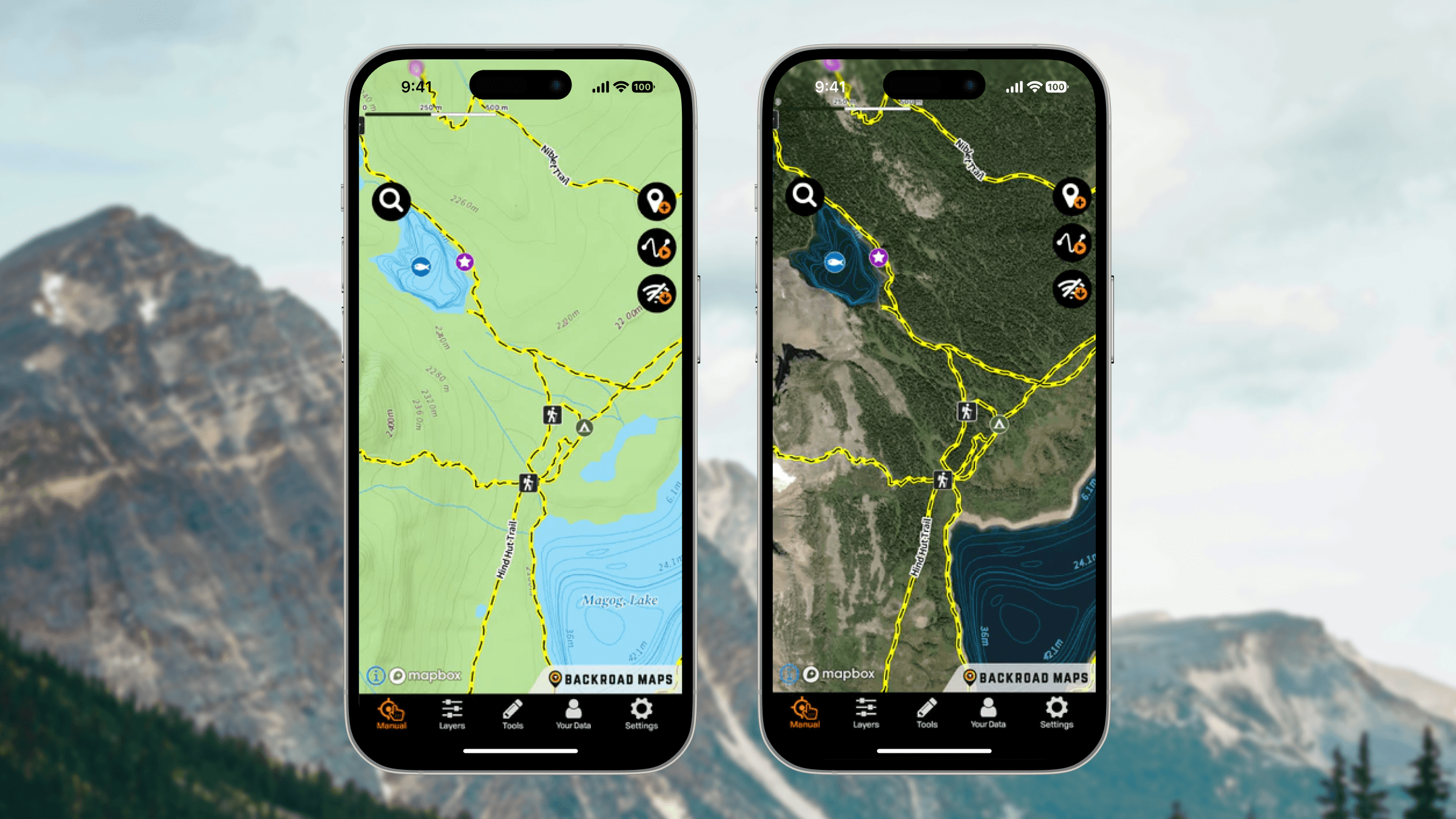
The Mapbox Mobile Maps SDKs provide the core basemap rendering for the application. Mapbox satellite imagery allows it to provide multiple basemap views, including an exclusive satellite view or a hybrid view with the proprietary Backroad Maps basemap data overlay on top. The hybrid view provides an even clearer and more contextual understanding of terrain, access points, and surrounding geography. Backroad Maps uses the Mapbox Search Box API so users can search for addresses or businesses that they want to visit during a trip.
Mapbox is continually introducing new features and functionality that offer Backroad Maps new ways to grow and improve its maps.
“Our project has continued to grow with Mapbox, delivering more and more advanced mapping features along the way. For example, when we initially started, we received numerous requests from our customers about 3D maps. We were able to upgrade to the latest Mapbox SDKs to deliver advanced 3D mapping capabilities for all of Canada - and drape our Adventure Overlays on top of those features!” David Mancini, GIS Manager & Developers, Backroad Maps
As the Backroad Maps app continues to evolve, so does customer demand — especially for more immersive and practical navigation features. The most recent addition to the Backroad Maps stack is the Mapbox Navigation SDK which enables support for Apple CarPlay and Android Auto. This transforms the mobile app into a complete navigation solution, helping users plan an excursion and then guiding them from their current location directly to outdoor destinations using the Mapbox routing engine — even in remote regions with no connectivity.
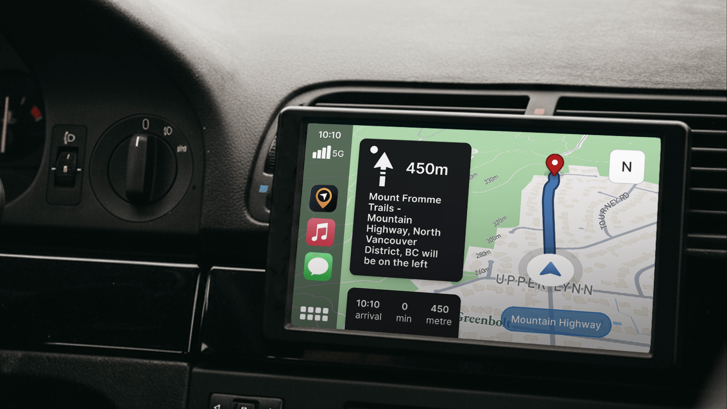
“The next biggest customer request was adding Apple CarPlay and Android Auto support, which we were able to deliver by using the Mapbox Navigation SDKs. This has taken our app to the next level as a fully fledged Navigation app, which has been a huge success for us.”
David Mancini, GIS Manager & Developers, Backroad Maps
Mapbox powers growth and stability at scale
Since building with Mapbox and releasing its new mobile apps, Backroad Maps has seen its user base grow. Particularly after launching turn-by-turn navigation, it has increased premium subscriptions by 15%, driving an incremental 25% in revenue. Mapbox has helped enable innovation by keeping infrastructure costs low during development and ultimately delivering a more stable, dependable app experience for users.
With a small, focused development team, Backroad Maps has also appreciated the support available from the Mapbox team.
“Another advantage of developing with Mapbox is the quality of support from their dedicated Support Team. We’ve worked directly with Mapbox developers to debug and resolve difficult integration issues. We’ve also met with many members of the Mapbox Team over the years to grow our business relationship and align our goals for success and growth moving forward.”
Russell Mussio, President & Co-founder, Backroad Maps
Most importantly, Mapbox has helped Backroad Maps deliver on its core promise: giving outdoor explorers the confidence to venture farther, plan better, and return safely.


